


| The World Factbook 2002 | ||
|
|
Sudan |
|
|
| Introduction | Sudan |
|
Background:
|
Military dictatorships favoring an Islamic-oriented government have dominated national politics since independence from the UK in 1956. Sudan has been embroiled in a civil war for all but 10 years of this period (1972-82). Since 1983, the war and war- and famine-related effects have led to more than 2 million deaths and over 4 million people displaced. The war pits the Arab/Muslim majority in Khartoum against the non-Muslim African rebels in the south. Since 1989, traditional northern Muslim parties have made common cause with the southern rebels and entered the war as a part of an anti-government alliance. |
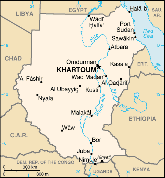
| Geography | Sudan |
|
Location:
|
Northern Africa, bordering the Red Sea, between Egypt and Eritrea |
|
Geographic coordinates:
|
15 00 N, 30 00 E |
|
Map references:
|
Africa |
|
Area:
|
total: 2,505,810 sq km
water: 129,810 sq km land: 2.376 million sq km |
|
Area - comparative:
|
slightly more than one-quarter the size of the US |
|
Land boundaries:
|
total: 7,687 km
border countries: Central African Republic 1,165 km, Chad 1,360 km, Democratic Republic of the Congo 628 km, Egypt 1,273 km, Eritrea 605 km, Ethiopia 1,606 km, Kenya 232 km, Libya 383 km, Uganda 435 km |
|
Coastline:
|
853 km |
|
Maritime claims:
|
contiguous zone: 18 NM
continental shelf: 200-m depth or to the depth of exploitation territorial sea: 12 NM |
|
Climate:
|
tropical in south; arid desert in north; rainy season (April to October) |
|
Terrain:
|
generally flat, featureless plain; mountains in east and west |
|
Elevation extremes:
|
lowest point: Red Sea 0 m
highest point: Kinyeti 3,187 m |
|
Natural resources:
|
petroleum; small reserves of iron ore, copper, chromium ore, zinc, tungsten, mica, silver, gold, hydropower |
|
Land use:
|
arable land: 7%
permanent crops: 0% other: 93% (1998 est.) |
|
Irrigated land:
|
19,500 sq km (1998 est.) |
|
Natural hazards:
|
dust storms and periodic persistent droughts |
|
Environment - current issues:
|
inadequate supplies of potable water; wildlife populations threatened by excessive hunting; soil erosion; desertification; periodic drought |
|
Environment - international agreements:
|
party to: Biodiversity, Climate Change, Desertification, Endangered Species, Law of the Sea, Nuclear Test Ban, Ozone Layer Protection
signed, but not ratified: none of the selected agreements |
|
Geography - note:
|
largest country in Africa; dominated by the Nile and its tributaries |
| People | Sudan |
|
Population:
|
37,090,298 (July 2002 est.) |
|
Age structure:
|
0-14 years: 44.2% (male 8,385,554; female 8,023,847)
15-64 years: 53.6% (male 9,945,683; female 9,933,383) 65 years and over: 2.2% (male 447,214; female 354,617) (2002 est.) |
|
Population growth rate:
|
2.73% (2002 est.) |
|
Birth rate:
|
37.21 births/1,000 population (2002 est.) |
|
Death rate:
|
9.81 deaths/1,000 population (2002 est.) |
|
Net migration rate:
|
-0.07 migrant(s)/1,000 population (2002 est.) |
|
Sex ratio:
|
at birth: 1.05 male(s)/female
under 15 years: 1.05 male(s)/female 15-64 years: 1 male(s)/female 65 years and over: 1.26 male(s)/female total population: 1.03 male(s)/female (2002 est.) |
|
Infant mortality rate:
|
67.14 deaths/1,000 live births (2002 est.) |
|
Life expectancy at birth:
|
total population: 57.33 years
female: 58.5 years (2002 est.) male: 56.22 years |
|
Total fertility rate:
|
5.22 children born/woman (2002 est.) |
|
HIV/AIDS - adult prevalence rate:
|
0.99% (1999 est.) |
|
HIV/AIDS - people living with HIV/AIDS:
|
186,000 (1998) |
|
HIV/AIDS - deaths:
|
NA |
|
Nationality:
|
noun: Sudanese (singular and plural)
adjective: Sudanese |
|
Ethnic groups:
|
black 52%, Arab 39%, Beja 6%, foreigners 2%, other 1% |
|
Religions:
|
Sunni Muslim 70% (in north), indigenous beliefs 25%, Christian 5% (mostly in south and Khartoum) |
|
Languages:
|
Arabic (official), Nubian, Ta Bedawie, diverse dialects of Nilotic, Nilo-Hamitic, Sudanic languages, English
note: program of "Arabization" in process |
|
Literacy:
|
definition: age 15 and over can read and write
total population: 46.1% male: 57.7% female: 34.6% (1995 est.) |
| Government | Sudan |
|
Country name:
|
conventional long form: Republic of the Sudan
conventional short form: Sudan local short form: As-Sudan local long form: Jumhuriyat as-Sudan former: Anglo-Egyptian Sudan |
|
Government type:
|
authoritarian regime - ruling military junta took power in 1989; government is run by an alliance of the military and the National Congress Party (NCP), formerly the National Islamic Front (NIF), which espouses an Islamist platform |
|
Capital:
|
Khartoum |
|
Administrative divisions:
|
26 states (wilayat, singular - wilayah); A'ali an Nil, Al Bahr al Ahmar, Al Buhayrat, Al Jazirah, Al Khartum, Al Qadarif, Al Wahdah, An Nil al Abyad, An Nil al Azraq, Ash Shamaliyah, Bahr al Jabal, Gharb al Istiwa'iyah, Gharb Bahr al Ghazal, Gharb Darfur, Gharb Kurdufan, Janub Darfur, Janub Kurdufan, Junqali, Kassala, Nahr an Nil, Shamal Bahr al Ghazal, Shamal Darfur, Shamal Kurdufan, Sharq al Istiwa'iyah, Sinnar, Warab |
|
Independence:
|
1 January 1956 (from Egypt and UK) |
|
National holiday:
|
Independence Day, 1 January (1956) |
|
Constitution:
|
12 April 1973, suspended following coup of 6 April 1985; interim constitution of 10 October 1985 suspended following coup of 30 June 1989; new constitution implemented on 30 June 1998 partially suspended 12 December 1999 by President BASHIR |
|
Legal system:
|
based on English common law and Islamic law; as of 20 January 1991, the now defunct Revolutionary Command Council imposed Islamic law in the northern states; Islamic law applies to all residents of the northern states regardless of their religion; some separate religious courts; accepts compulsory ICJ jurisdiction, with reservations |
|
Suffrage:
|
17 years of age; universal, but noncompulsory |
|
Executive branch:
|
chief of state: President Lt. Gen. Umar Hasan Ahmad al-BASHIR (since 16 October 1993); First Vice President Ali Uthman Muhammad TAHA (since 17 February 1998), Second Vice President Moses MACHAR (since 12 February 2001); note - the president is both the chief of state and head of government
elections: president elected by popular vote for a five-year term; election last held 13-23 December 2000 (next to be held NA 2005) note: BASHIR assumed supreme executive power in 1989 and retained it through several transitional governments in the early and mid-90s before being popularly elected for the first time in March 1996 election results: Umar Hasan Ahmad al-BASHIR reelected president; percent of vote - Umar Hasan Ahmad al-BASHIR 86.5%, Ja'afar Muhammed NUMAYRI 9.6%, three other candidates received less than a combined 4% of the vote; election widely viewed as rigged; all popular opposition parties boycotted elections because of a lack of guarantees for a free and fair poll cabinet: Council of Ministers appointed by the president; note - the National Congress Party or NCP (formerly the National Islamic Front or NIF) dominates BASHIR's cabinet head of government: President Lt. Gen. Umar Hasan Ahmad al-BASHIR (since 16 October 1993); First Vice President Ali Uthman Muhammad TAHA (since 17 February 1998), Second Vice President Moses MACHAR (since 12 February 2001); note - the president is both the chief of state and head of government |
|
Legislative branch:
|
unicameral National Assembly (360 seats; 270 popularly elected, 90 elected by supra assembly of interest groups known as National Congress; members serve four-year terms)
elections: last held 13-22 December 2000 (next to be held NA December 2004) note: on 12 December 1999, BASHIR dismissed the National Assembly during an internal power struggle between the president and the speaker of the National Assembly Hassan al-TURABI election results: NCP 355, others 5 |
|
Judicial branch:
|
Supreme Court; Special Revolutionary Courts |
|
Political parties and leaders:
|
the government allows political "associations" under a 1998 law revised in 2000; to obtain government approval parties must accept the constitution and refrain from advocating or using violence against the regime; approved parties include the National Congress Party or NCP [Ibrahim Ahmed UMAR], Popular National Congress or PNC [Hassan al-TURABI], and over 20 minor, pro-government parties |
|
Political pressure groups and leaders:
|
National Congress Party [Ibrahim Ahmed UMAR]; Popular National Congress [Hassan al-TURABI]; Umma [Sadiq al-MAHDI]; Democratic Unionist Party [Muhammed Uthman AL-MIRGHANI]; National Democratic Alliance [Muhammed Uthman AL-MIRGHANI, chairman]; Sudan People's Liberation Movement/Army [Dr. John GARANG] |
|
International organization participation:
|
ABEDA, ACP, AfDB, AFESD, AL, AMF, CAEU, CCC, ECA, FAO, G-77, IAEA, IBRD, ICAO, ICRM, IDA, IDB, IFAD, IFC, IFRCS, IGAD, ILO, IMF, IMO, Interpol, IOC, IOM, ISO (correspondent), ITU, NAM, OAU, OIC, OPCW, PCA, UN, UNCTAD, UNESCO, UNHCR, UNIDO, UNU, UPU, WFTU, WHO, WIPO, WMO, WToO, WTrO (observer) |
|
Diplomatic representation in the US:
|
chief of mission: Ambassador (vacant); Charge D'Affairs, Ad Interim Khidir Haroun AHMED (since April 2001)
telephone: [1] (202) 338-8565 FAX: [1] (202) 667-2406 chancery: 2210 Massachusetts Avenue NW, Washington, DC 20008 |
|
Diplomatic representation from the US:
|
For security reasons, US officials at the US Embassy in Khartoum were relocated in February 1996 to the US Embassies in Nairobi, Kenya, and Cairo, Egypt, from where they make regular visits to Khartoum; the US Embassy in Khartoum is located on Sharia Abdul Latif Avenue; mailing address - P. O. Box 699, Khartoum; APO AE 09829; telephone - [249] (11) 774611 or 774700; FAX - [249] (11) 774137; the US Embassy in Nairobi, Kenya is located in the Interim Office Building on Mombasa Road, Nairobi; mailing address - P. O. Box 30137, Box 21A, Unit 64100, APO AE 09831; telephone - [254] (2) 751613; FAX - [254] (2) 743204; the US Embassy in Cairo, Egypt is located at (North Gate) 8, Kamel El-Din Salah Street, Garden City, Cairo; mailing address - Unit 64900, APO AE 09839-4900; telephone - [20] (2) 3557371; FAX - [20] (2) 3573200 |
|
Flag description:
|
three equal horizontal bands of red (top), white, and black with a green isosceles triangle based on the hoist side |
| Economy | Sudan |
|
Economy - overview:
|
Sudan has turned around a struggling economy with sound economic policies and infrastructure investments, but it still faces formidable economic problems. Starting in 1997 Sudan began implementing IMF macroeconomic reforms that have successfully stabilized inflation. In 1999 Sudan began exporting crude oil and in the last quarter of 1999 recorded its first trade surplus, along with monetary policy, has stabilized the exchange rate. Current oil production stands at 220,000 barrels per day, of which some 70% is exported and the rest refined mostly for domestic consumption. Increased oil production, revived light industry, and expanded export processing zones should maintain GDP growth at 5% in 2002. Agriculture production remains Sudan's most important sector, employing 80% of the work force and contributing 43% of GDP, but most farms remain rain-fed and susceptible to drought. Sudan is also constrained by its limited access to international credit; most of Sudan's $24.9 billion debt remains in arrears. The civil war, chronic instability, adverse weather, and weak world agricultural prices ensure that much of the population will remain at or below the poverty line for years. |
|
GDP:
|
purchasing power parity - $49.3 billion (2001 est.) |
|
GDP - real growth rate:
|
5.5% (2001 est.) |
|
GDP - per capita:
|
purchasing power parity - $1,360 (2001 est.) |
|
GDP - composition by sector:
|
agriculture: 43%
industry: 17% services: 40% (1999 est.) |
|
Population below poverty line:
|
NA% |
|
Household income or consumption by percentage share:
|
lowest 10%: NA%
highest 10%: NA% |
|
Inflation rate (consumer prices):
|
10% (2001 est.) |
|
Labor force:
|
11 million (1996 est.) |
|
Labor force - by occupation:
|
agriculture 80%, industry and commerce 7%, government 13% (1998 est.) |
|
Unemployment rate:
|
18.7% (2002 est.) |
|
Budget:
|
revenues: $1.6 billion
expenditures: $1.9 billion, including capital expenditures of $NA (2001 est.) |
|
Industries:
|
oil, cotton ginning, textiles, cement, edible oils, sugar, soap distilling, shoes, petroleum refining, pharmaceuticals, armaments, automobile/light truck assembly |
|
Industrial production growth rate:
|
8.5% (1999 est.) |
|
Electricity - production:
|
1.97 billion kWh (2000) |
|
Electricity - production by source:
|
fossil fuel: 49.24%
hydro: 50.76% other: 0% (2000) nuclear: 0% |
|
Electricity - consumption:
|
1,832.1 million kWh (2000) |
|
Electricity - exports:
|
0 kWh (2000) |
|
Electricity - imports:
|
0 kWh (2000) |
|
Agriculture - products:
|
cotton, groundnuts (peanuts), sorghum, millet, wheat, gum arabic, sugarcane, cassava (tapioca), mangos, papaya, bananas, sweet potatoes, sesame; sheep, livestock |
|
Exports:
|
$2.1 billion (f.o.b., 2001 est.) |
|
Exports - commodities:
|
oil and petroleum products, cotton, sesame, livestock, groundnuts, gum arabic, sugar |
|
Exports - partners:
|
Japan 25%, China 19%, Saudi Arabia 14%, Germany 4%, (2000) |
|
Imports:
|
$1.6 billion (f.o.b., 2001 est.) |
|
Imports - commodities:
|
foodstuffs, manufactured goods, refinery and transport equipment, medicines and chemicals, textiles, wheat |
|
Imports - partners:
|
China 12%, Saudi Arabia 10%, UK 10%, Germany 7% (2000) |
|
Debt - external:
|
$24.9 billion (2000 est.) |
|
Economic aid - recipient:
|
$187 million (1997) |
|
Currency:
|
Sudanese dinar (SDD) |
|
Currency code:
|
SDD |
|
Exchange rates:
|
Sudanese dinars per US dollar - 261.44 (January 2002), 258.70 (2001), 257.12 (2000), 252.55 (1999), 200.80 (1998), 157.57 (1997) |
|
Fiscal year:
|
calendar year |
| Communications | Sudan |
|
Telephones - main lines in use:
|
400,000 (2000) |
|
Telephones - mobile cellular:
|
20,000 (2000) |
|
Telephone system:
|
general assessment: large, well-equipped system by regional standards and being upgraded; cellular communications started in 1996 and have expanded substantially
domestic: consists of microwave radio relay, cable, radiotelephone communications, tropospheric scatter, and a domestic satellite system with 14 earth stations international: satellite earth stations - 1 Intelsat (Atlantic Ocean) and 1 Arabsat (2000) |
|
Radio broadcast stations:
|
AM 12, FM 1, shortwave 1 (1998) |
|
Radios:
|
7.55 million (1997) |
|
Television broadcast stations:
|
3 (1997) |
|
Televisions:
|
2.38 million (1997) |
|
Internet country code:
|
.sd |
|
Internet Service Providers (ISPs):
|
2 (2002) |
|
Internet users:
|
50,000 (2002) |
| Transportation | Sudan |
|
Railways:
|
total: 5,995 km
narrow gauge: 4,595 km 1.067-m gauge; 1,400 km 0.600-m gauge plantation line note: the 1.067-m line from Khartoum to Port Sudan carries over two-thirds of Sudan's rail traffic; the 0.600-m gauge system serves Sudan's cotton plantations with over 120 collecting stations (2001) |
|
Highways:
|
total: 11,900 km
paved: 4,320 km unpaved: 7,580 km (1996) |
|
Waterways:
|
5,310 km |
|
Pipelines:
|
refined products 815 km |
|
Ports and harbors:
|
Juba, Khartoum, Kusti, Malakal, Nimule, Port Sudan, Sawakin |
|
Merchant marine:
|
total: 4 ships (1,000 GRT or over) totaling 39,545 GRT/51,195 DWT
ships by type: cargo 2, roll on/roll off 2 (2002 est.) |
|
Airports:
|
65 (2001) |
|
Airports - with paved runways:
|
total: 12
over 3,047 m: 1 2,438 to 3,047 m: 8 1,524 to 2,437 m: 3 (2001) |
|
Airports - with unpaved runways:
|
total: 53
under 914 m: 11 (2001) 1,524 to 2,437 m: 16 914 to 1,523 m: 26 |
|
Heliports:
|
1 (2001) |
| Military | Sudan |
|
Military branches:
|
Army, Navy, Air Force, Popular Defense Force Militia |
|
Military manpower - military age:
|
18 years of age (2002 est.) |
|
Military manpower - availability:
|
males age 15-49: 8,739,982 (2002 est.) |
|
Military manpower - fit for military service:
|
males age 15-49: 5,380,917 (2002 est.) |
|
Military manpower - reaching military age annually:
|
males: 398,294 (2002 est.) |
|
Military expenditures - dollar figure:
|
$581 million (2001 est.) |
|
Military expenditures - percent of GDP:
|
2.5% (1999) |
| Transnational Issues | Sudan |
|
Disputes - international:
|
Sudan agrees in 2002 to demarcate whole boundary with Ethiopia; Egypt and Sudan each claim to administer triangular areas which extend north and south of the 1899 Treaty boundary along the 22nd Parallel (the north "Hala'ib Triangle" is the largest with 20,580 sq km); in 2001, the two states agreed to discuss an "area of integration" and withdraw military forces in the overlapping areas; since colonial times, Kenya's administrative boundary has extended beyond its treaty boundary into Sudan creating the "Ilemi Triangle" |
|
This page was last updated on 1 January 2002 |